About
During emergency events, CrisisReady team provides daily situation reports (“ReadyReports”) to emergency and humanitarian response agencies around the world. These agencies include those responding to large-scale humanitarian crises, as well as natural disasters such as hurricanes, earthquakes, and floods.
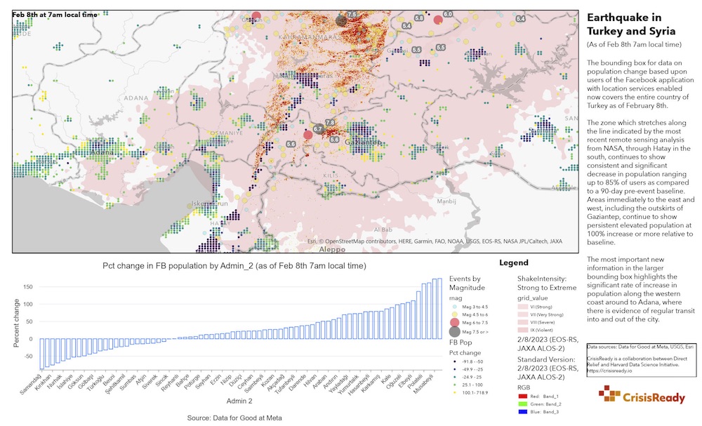
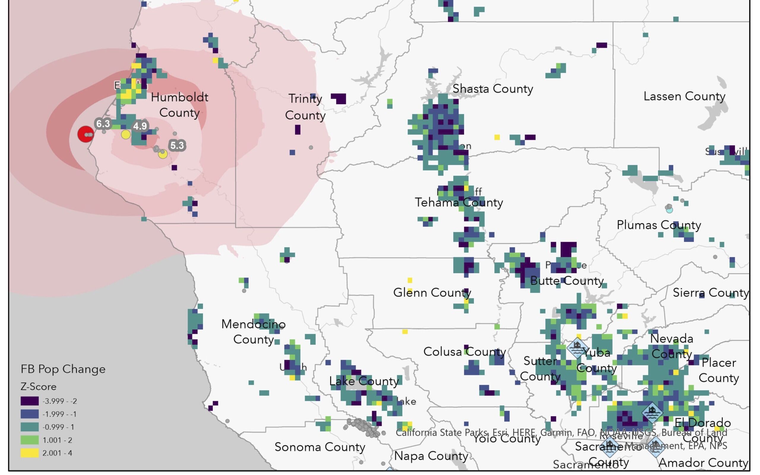
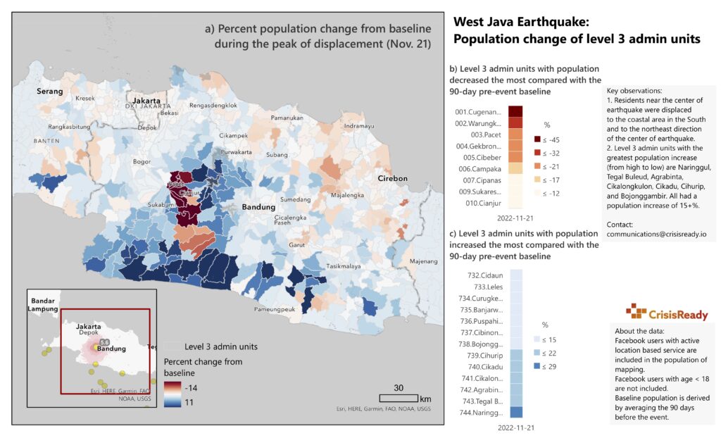
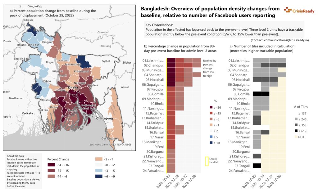
Each report is generated using aggregated mobility data provided by Data for Good at Meta, a program that leverages data to support disaster response around the world. Changes in population densities, which provide signals to population movement, were determined by calculating the percent difference between the number of users on Meta applications during the time of analysis compared to baseline values recorded 90-days before the earthquakes struck. Data from United States Geological Survey (USGS) and ESRI are also used regularly in the reports.
Recent Reports
CrisisReady’s situation reports provide insights on population displacement dynamics during disaster events. Equipped with this information, responders can better align response operations to target key communities in-need.